Blog
How Mines Use GPS for Unstoppable Efficiency: 5 Powerful Benefits
Starting in the early 90’s, Mines use GPS in a


Starting in the early 90’s, Mines use GPS in a
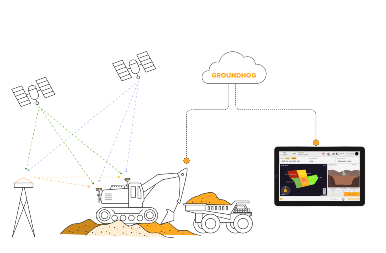
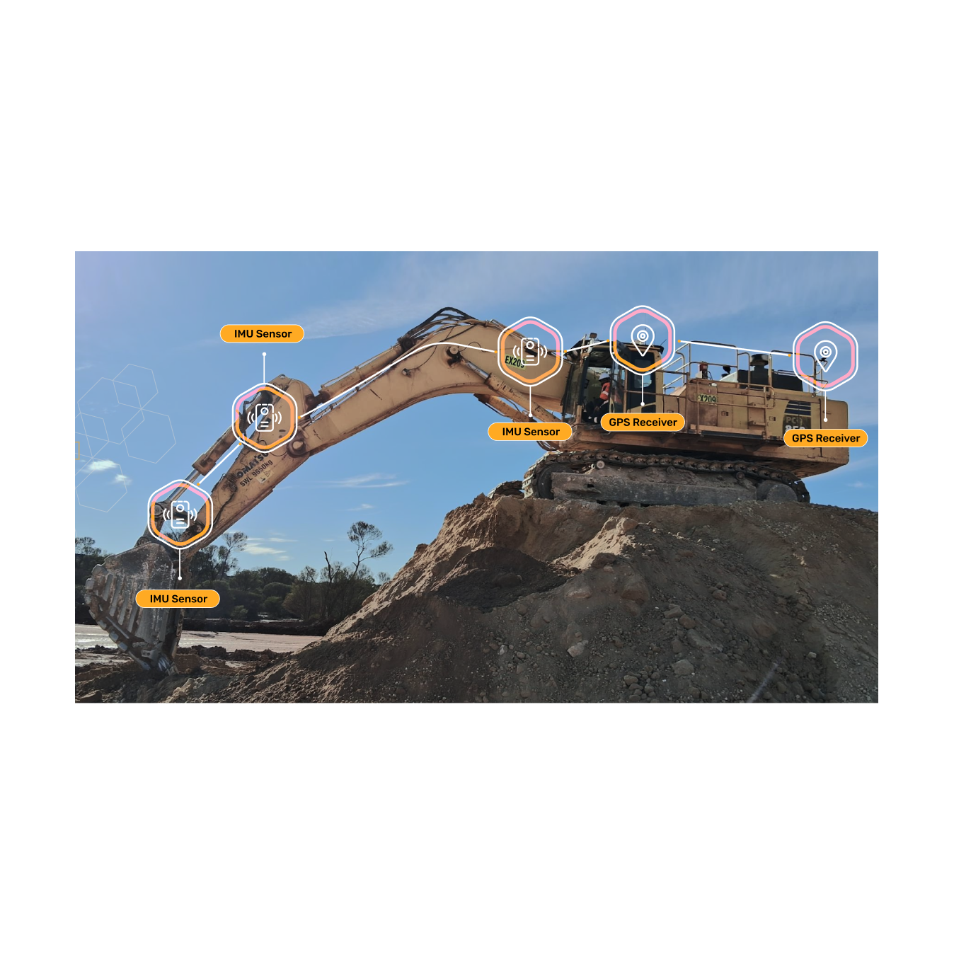
RTK (Real-Time Kinematic) and GNSS (Global Navigation Satellite System) are
RTK (Real-Time Kinematic) High Precision GPS technology comes is primarily